|
|
|
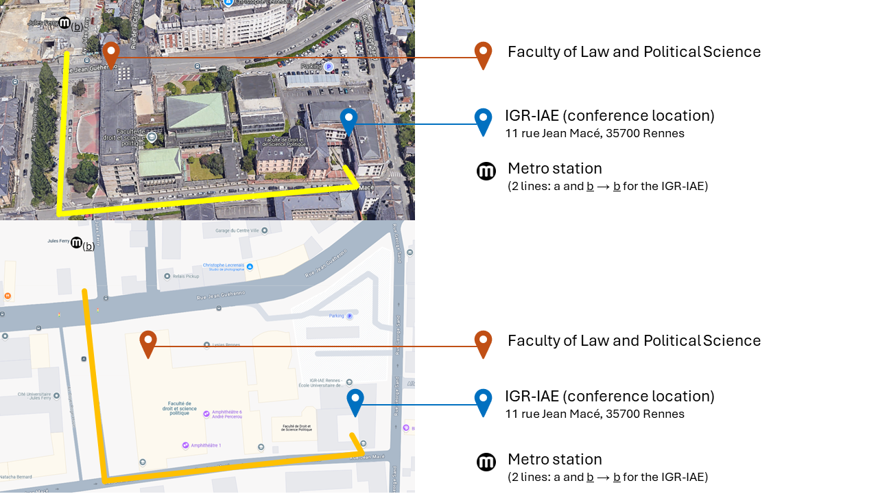
Practical Information > Getting Around Rennes & Accessing the Venue
Transport in RennesPublic TransportThe STAR network (Service des Transports en Commun de l'Agglomération Rennaise) operates Rennes' public transport system, including metro lines, buses, and other mobility services across the city and its metropolitan area. You can conveniently use your contactless bank card directly on validators in both the metro and buses.
The STAR network map is available here (only in French). See PDF of STAR metro lines here. City MapsTourist maps of Rennes are available online in English and French. Getting to the IGR-IAEThe nearest metro station is Jules Ferry (line b), located approximately 350 metres from the IGR-IAE. From the station:
Map design: Rebecca Dickason (2026) |